map skills
Maps have several different features that have to be understood in order to use. The following are key features that will almost always be included on a map.
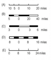
Scale: A map scale is the device that is used to measure approximate distance on a map. Since maps are larger areas shrunk down to a miniature size on paper, you have to use a scale if you are to understand the size of the area. A typical scale would look something like these:
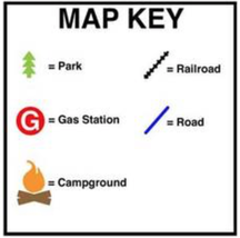
Legend or Key: All maps should have a legend or key if they include symbols. The legend will provide an explanation for what the symbols mean. The viewer of the map will then be able to understand what is on the map. A typical legend or key may look something like this:
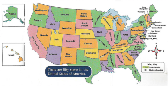
Compass Rose: A compass rose will show the Cardinal (North, South, East, West) and the intermediate (Northeast, Northwest, Southeast, Southwest) directions. This is an important feature if you are to explain the relative location of something on a map.
For example, if I was using the compass rose on the map below I can say that Ohio is North of Florida and South of Michigan.
For example, if I was using the compass rose on the map below I can say that Ohio is North of Florida and South of Michigan.